Buffer Program Update
Buffer Program Ordinance Updates
The Minnesota Board of Water and Soil Resources (BWSR) has updated its comprehensive model ordinance language to reflect changes related to Board-adopted procedures and revisions to the Administrative Penalty Order (APO). While many of these updates are elective, certain revisions are required to ensure the Buffer Ordinance provisions align with those document requirements that include sufficient provisions for effective compliance and enforcement of Minn. Stat. § 103F.48 (the buffer law). Incorporating these required updates is necessary to obtain a determination of jurisdiction under Minn. Stat. § 103F.48, Subd. (j). These changes can be viewed on the Enforcement Page.
Buffer Program Procedures
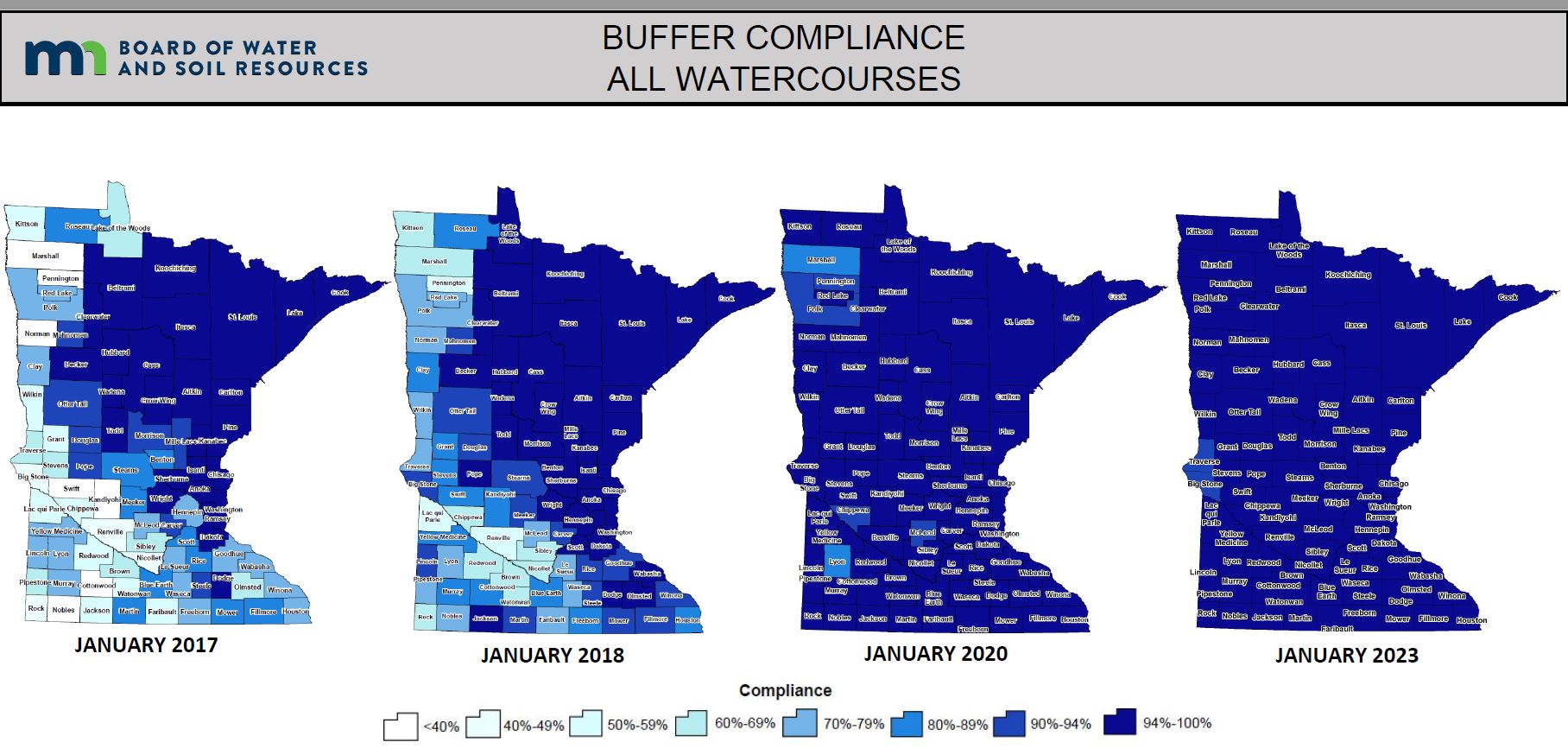
The current procedures were adopted in 2017, to support the implementation of the Riparian Protection and Water Quality Practices Statute (Minn. Stat. § 103F.48), commonly referred to as the Buffer Law. These procedures establish a consistent framework for implementation by soil and water conservation districts, as well as counties and watershed districts that have assumed jurisdiction.
Following legislative amendments to the statute in 2024, BWSR has revised the procedures to ensure alignment with current law. Concurrently, BWSR has incorporated updates and refinements informed by program implementation experience. The revised procedures have been reorganized into a series of renumbered chapters and updated for clarity and improved cross-referencing.
Two new procedures have been added as part of this process:
Procedure No. 8: Implementation of Jurisdictional Responsibilities
Procedure No. 10: Revoking Jurisdiction of a County or Watershed District
The revised Buffer Program procedures can be found here (pdf)